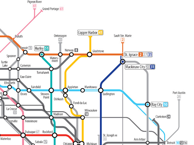
The Economist posted, January 7th 2012, an interesting map showing
U.S. routes, as opposed to the Interstates. This map has been designed by an Australian designer,
Cameron Booth who shares his effort to the magazine:
I have to say that without a doubt, this is the most complex network that I have yet attempted. Not only are there far more numbered routes than in the Interstate system, but there are also historical extensions and branches of many routes to consider.
In some cases, numbers that were used once were reused in different parts of thecountry (see U.S. 48, which has been used for three completely separate roads!). I have attempted to show these historical roads as thinner route lines "behind" the main network, including the most famous U.S. highway of all — Route 66, which gets special treatment, being solid black in colour.
According to
Booth, "
The U.S. Routes [mainly] conform to a numbered grid system." I agree with
The Economist, this map is very impressive. It apparently has taken
Cameron Booth well over a year to complete, the designer confesses.
[…] I restarted my work on three separate occasions, each time almost convinced that this map was impossible. This last time, I started at the most complex intersection of roads on the map — Memphis, Tennessee — and solved it first. Once that resolved itself, clues were revealed as to how to approach the rest ot the map and things got a lot easier.
So much so, that in the end, I was even able to add some of the longer "child" three-digit routes, some of which are actually longer than their so-called "parent" route. U.S. 191 runs from Canada to Mexico, while U.S. 91 has been cut back down over the decades to a very short stretch between Idaho Falls, ID and Brigham City, UT.
A nice work, to conclude.
More:
The Economist and
Cameron Booth.


No comments:
Post a Comment